Where is Erlistoun??? Latitude 27″ 59′ 03″ S Longitude 122″ 20′ 25″ East Mt Margaret Goldfields. Located 71.5 km north of Laverton at Borodale Creek once known as Mistake Creek.
Erlistoun usually referred to as ‘The Erlistoun’ was never gazetted as a townsite under the lands act, but was surveyed as a Business and Residential Area under the Mining Act in Oct 1897. The name was taken from the Erlistoun Creek nearby which had been recorded and named by L A Wells during the 1891-1892 Elder Exploring Expedition. The origin of the name is not known.
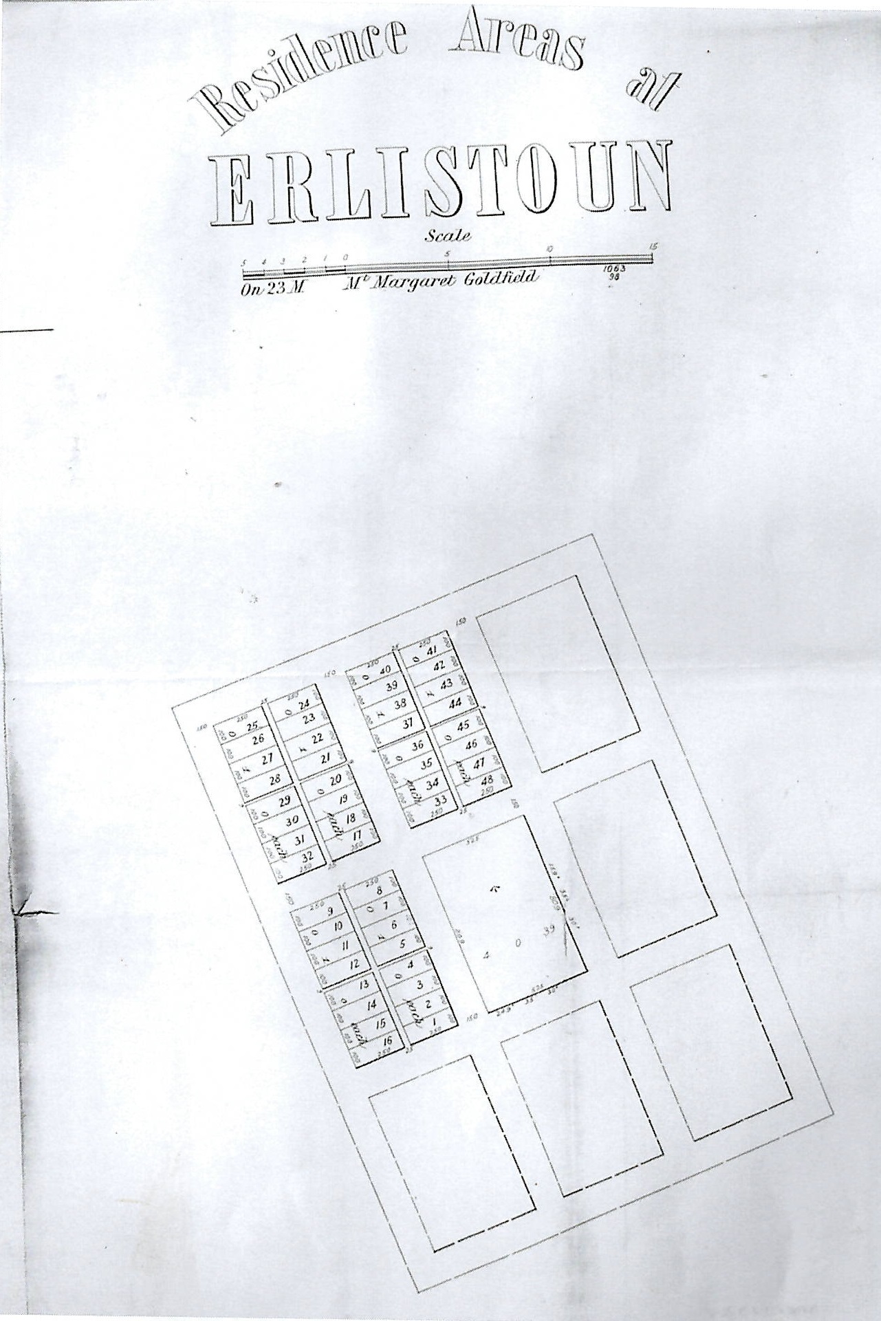
Erlistoun Business and Residential Area – SLWA
The main mine in the area was the King of Creation discovered by Peter McNee and Bob and Bill Clarke in 1897. In Jan1898 an inspecting surveyor, Harry King, advised the Surveyor General that no townsite should be declared at that time. He also included a list of mines at the time:
The King of Creation Mine
The Mistake Mine
The Gladys Mine
King of the Erlistoun Mine
Little Doris Mine
Golden Boulder Mine
The Famous Mine
The Mount Maiden
Baneygo Mine
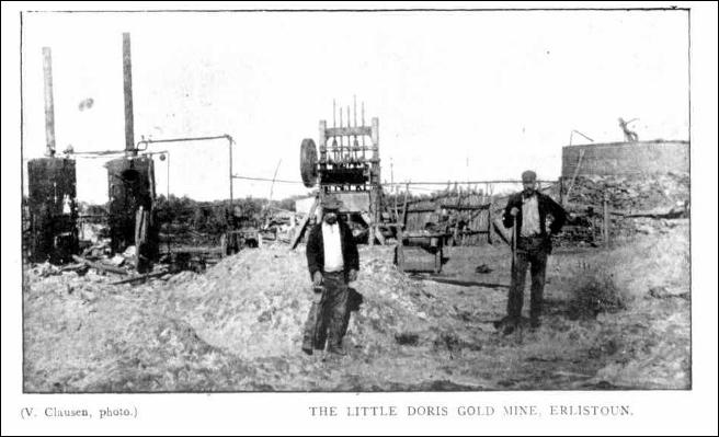
Little Doris GM Erlistoun – Kalgoorlie Western Argus 13 December 1904, page 20
In Dec 1898 Mr. King was again asked if it was time to declare a townsite for which he replied that the place was very quiet and almost deserted.
Erlistoun Station (AKA Erliston) is a pastoral lease that has operated as a cattle station and more recently as a sheep station in Western Australia. It is situated approximately 72 kilometers (45 miles) to the north of Laverton and 162 kilometers (101 mi) east of Leinster in the Goldfields-Esperance region. Borodale Creek runs through the property from Davis Pool on the northern boundary meandering through waterholes to Namendarra Lake on the southern boundary.
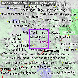
Erlistoun Location – Bonzle Maps
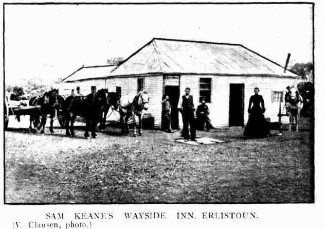
Sam Keanes Wayside Inn, Erlistoun – Photo Kalgoorlie Western Argus 13 December 1904, page 19
Erlistoun was known as a district in the area before the station was established. The pastoral lease was first taken up by Butcher and Uhr in 1904, originally on a block extending northward from Laverton for a distance of 55 miles (89 km) with a width of 40 miles (64 km). The company was initially running cattle at Erlistoun, 1,000 head of which they had overlanded down from the Kimberley.
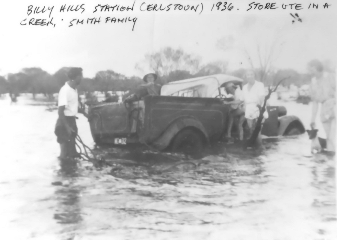
Billy Hills Station, Erlistoun 1936 – Store Ute in Creek – Photo The Smith Family
The Emanuel brothers owned the property in 1911 when it was sold to Kalgoorlie-Boulder Firewood Company. At this time the property occupied an area of 519,000 acres (210,032 ha) and was still running cattle. In 1924 the property was estimated to be carrying 5,500 head of cattle. By 1925 the size of the property was estimated as being 1,000,000 acres (404,686 ha) and was stocked with 4,000 head of cattle. Sheep had been introduced to the property by this time and in 1926 it was stocked with 7,000 cattle and 5,000 sheep. Shearing the same year yielded 31 bales of wool per 1,000 sheep. Another 4,000 sheep were due to arrive at the station in late 1926.
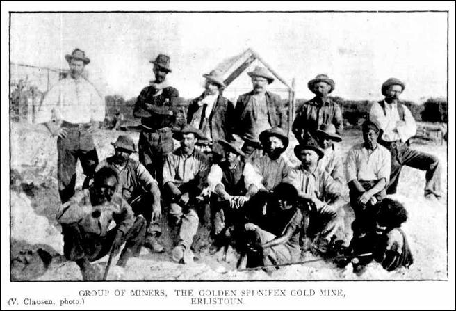
Group of Miners at the Golden Spinifex Mine, Erlistoun – Photo SLWA
Sunday Times 9 February 1930, page 1
THE ERLISTOUN STATION
A WELL-EQUIPPED PROPERTY
NORTH OF LAVERTON
On March 3, 1911, the Erlistoun Pastoral Co., Ltd. (then the Kalgoorlie and Boulder Firewood Co., Ltd.), purchased from Messrs. Emanuel Bros. the Erlistoun station, consisting of about 500,000 acres, with all stock. Messrs. Emanuel Bros. had used this property for the purpose of topping up for the market the cattle they brought from their properties further north.
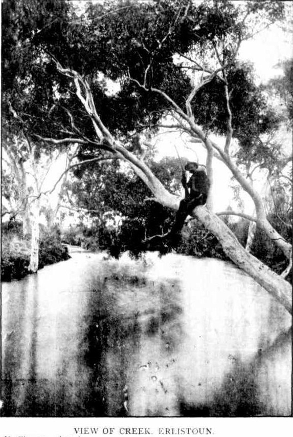
View of the creek, Erlistoun – Western Argus 13 Dec 1904
Shortly afterward this area was increased and now contains about one million acres. Through it runs the Borodale Creek from Davis Pool on the northern boundary, meandering through waterholes down to Namendarra Lake, near the southern boundary, passing in its course the Granite Pools, which hold an immense quantity of water, and are one of the beauty spots of the northern country.
A great deal of money has been spent on improvements, both in fencing and securing water, and it is now one of the best-watered properties in the north. The station has been used for breeding and fattening cattle, and has carried upwards of 6000 head at times. In 1925 the directors decided to add sheep to the proposition and commenced further improvements on a large scale to make provision for them, in the way of well sinking, fencing, both wire and wire netting, and subdivisional paddocks. The western side of the station, approximately one-half of the run, has been prepared for sheep. On it there are about 80 miles of wire netting fence, which was erected as a protection against dingoes; later when the danger of the dingo had practically disappeared owing to the good bonus paid for scalps, and the country on the eastern side being taken up by pastoralists, the ordinary boundary fences of 5 and 6 wires were erected.
On the sheep station, there are 42 wells equipped with windmills, pipes, troughs, etc., also two 7000-gallon tanks each at each well. The area is subdivided into 33 paddocks. There is a very commodious shearing shed, with six stands, good and roomy sheep yards, men’s quarters, complete, and a compact bungalow which is occupied by Mr. Cuthbert Porter, who supervises the sheep. It is expected that there will be about 14,000 to shear this year.
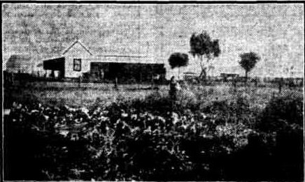
The Erlistoun Homestead and Garden
On the cattle portion, there is a very comfortable homestead, with men’s quarters, a garage, a blacksmith’s shop, wireless apparatus, and flower and vegetable gardens. Mr. James Hennessy, who controls the whole property, resides there. Altogether on the property, there are 84 wells, equipped with windmills, troughs, etc, concrete and iron tanks with a total capacity of about one million gallons of water, also about 500 miles of sheep and cattle fencing. The average rainfall is about 9¾in.
BROSNAN Daniel Patrick– died 26 Feb 1903 – aged 1 year (Born in Laverton WA in 1902) – Son Jeremiah BROSNAN and Hannah nee WALSH who were married in 1882 in Canterbury NSW.
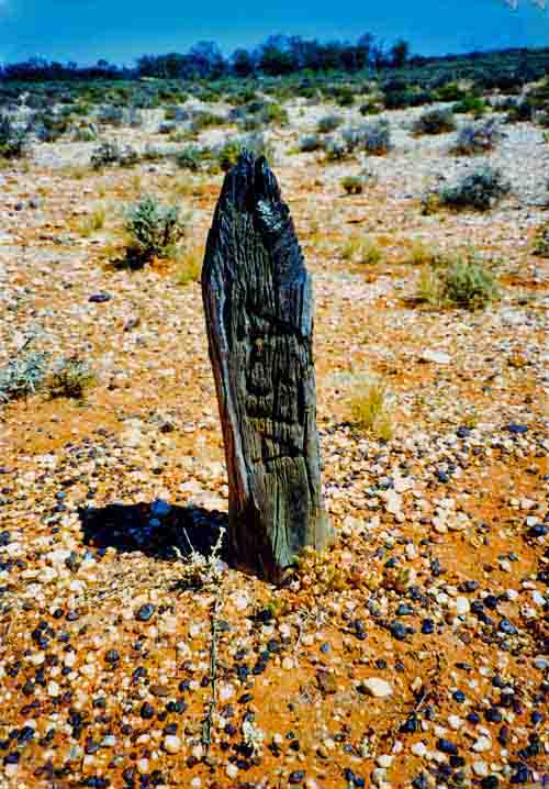
Erlistoun Cemetery Survey Peg – Photo Andrea Lewis and Jill Heather
Ref: TROVE – West Australian Gold Towns and Settlement Vol 1

Leave a Reply