Kunanalling or the 25 Mile
Latitude 30 141’ S Longitude 121 04’ E
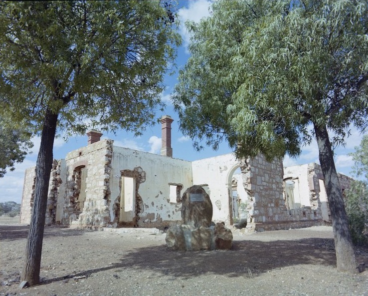
SLWA -321230PD: Ruins of the Premier Hotel, Kunanalling – 1987
In December of 1892, James Speakman and the party found gold 25 miles from Coolgardie and 17 miles north of Mt Burgess. Speakman pegged a lease but did not apply for an exemption when he left it on account of lack of water. A man called Adams re-pegged and won the resulting case. He sold the lease to a company, and it became the Premier GM which developed into a rich mine. As several other mines opened in the vicinity, a town, Kunanalling came into being. The town was originally called the 25 miles as it was 25 teamster miles on the old road to Menzies.
The Premier was the rich mine of the district, particularly in the early years, and its total production to the end of 1900 was 34,626 ounces of gold from 43,420 tons of stone. There were several other leases on a long line of the gold-bearing country which helped to support Kunanalling for many years. One was the True Blue GM later renamed the Blue Bell GM and was run by C H Ware and partners after 1904. The men erected a five-head battery and as well as treating dirt from their own mine they crushed ore for the public.
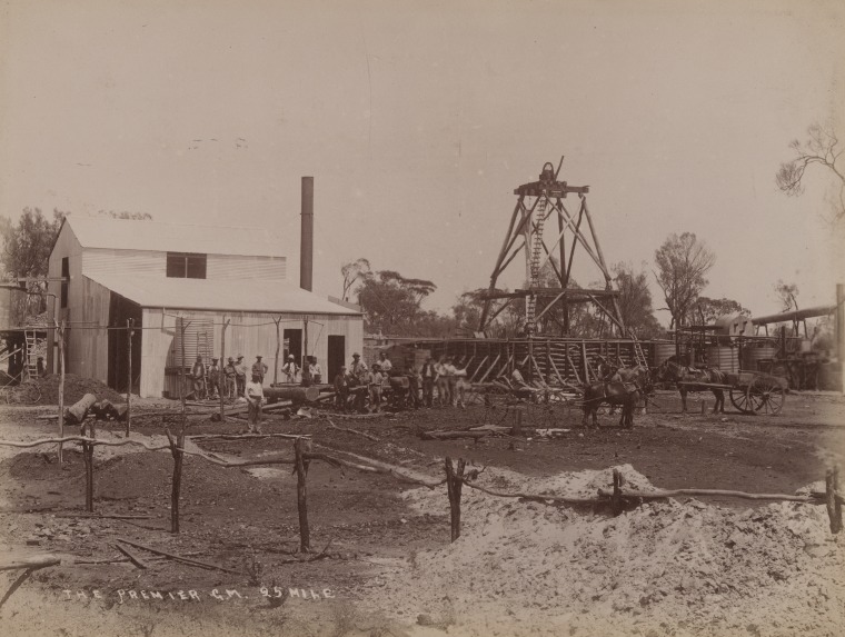
The Premier Gold Mine, 25 Mile Kunanalling, ca.1896 – SLWA
C Ware eventually took over the property alone and continued to operate the mine and battery till 1928. Some of the other good producers in the area were Blacketts Star of Fremantle and the Shamrock.
Kunanalling was at its height early in the century and possessed three hotels including Bowes stone and brick Premier Hotel the ruins of which can still be seen today. One of the early hotels in the town or in the area must have sold some questionable liquor and in 190 ‘Outback Joe’ wrote a satirical little poem called ‘A Ledged of the 25 Mile. It reads in part:
He built a slap-bang little pub
Would buy a bit of gold
As whiskey, brandy, wine, or gin
strong turpentine he sold.The bar was copper-bottomed
Whereon the boozers stood
For fear the red-hot liquid
Might burn away the woodOne day a drunk upset his glass
The first had made him tight
And in a twinkling of an eye
The place was all alight
There were eight streets in the town, Namely Balfour, Chamberlain, Gladstone, Salisbury, Harcourt, Rosebery, and Jameson. The town must have been going through a patriotic phase by naming its streets after British Prime Ministers. Its buildings included shops, a Mechanics Institute, a Government building, and a school. The latter closed in 1927 and was moved to Tammin where it became a farmer’s homestead.
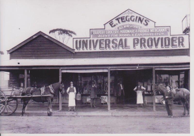
Teggins Store Kunanalling with Tom Coward outside
The wood and iron from building in the early Goldfields were often shifted to other sites when there was no further use to them in a dying town. The cost of materials is too high to abandon them.
In the mining revival of the 1930s, a school was once again needed at Kunanalling, so the original Post Office was used for this purpose. Seeing that the old road to Menzies went through Kunanalling Cobb and Co changed their horses there and at one time provided daily service from Coolgardie to Menzies.
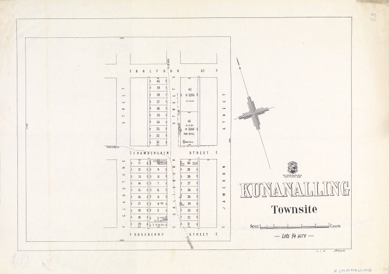
Kunanalling Tow site map
As other small settlements such as Dunnesville, Jordie Hills, Kintore, etc died out, Kunanalling became the main centre for miners left working in these areas and was, therefore, the most important little town north of Coolgardie. However, it too, lived only as long as the gold in the district remained profitable to work, and when that ceased the town finally died and the last resident left in 1942.
Ref: Kunanalling and Beyond by S R Bounsell

Well done. I’ve enjoyed reading.